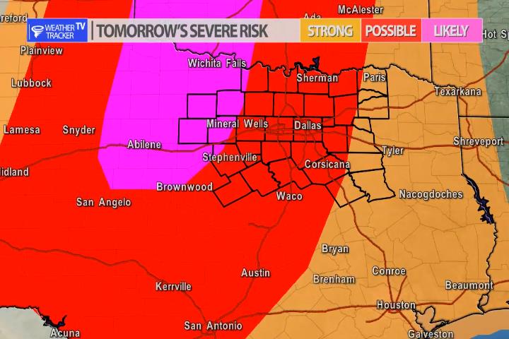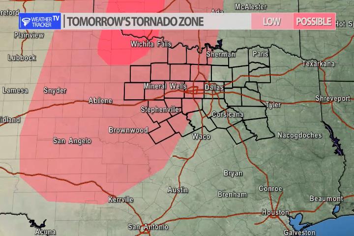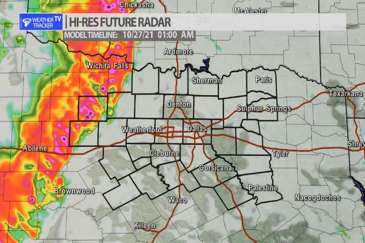

The risk of severe weather returns to North Texas tomorrow Tuesday – but the timeline is evening into early Wednesday morning. A strong Jet stream storm system will approach the area along with a cold front. All of that will focus late in the day first out in the Big Country with storms developing there around 7 pm. The storms will then morph into a line and push slowly east through the evening toward the Metroplex early in the morning Wednesday. Wind gusts over 60 mph, hail larger than half dollars are all possible and there is also a limited tornado threat as well.
