NOW Update 2:42 PM : Archer & Clay Counties

Texas Weather Tracker TV Alert

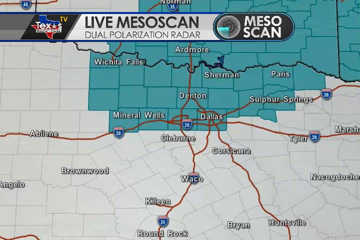
From William Cole: AT 239 PM CDT, a strong T-Storm was located 6 miles south of Windthorst, moving northeast at 30 MPH. You can expect Hail up to the size of nickels Wind gusts to 50 MPH PRECAUTIONARY/PREPAREDNESS ACTIONS Monitor the weather situation closely and be alert for threatening weather conditions.

Stay with William Cole and Texas Weather Tracker TV for continuing coverage, online, on our app and on TV.

If you have not already downloaded the Free Texas Weather Tracker TV mobile app – do that now. Search your app store for Texas Weather Tracker TV. Also, add our free Live Channel to your TV through Roku, Apple or Amazon Fire TV.

NOW Update Tuesday 2:36 PM: Comanche County

Texas Weather Tracker TV Alert

From William Cole: At 235 PM CDT, MesoScan Radar was tracking a cluster of strong T-Storms over Rising Star and southern Eastland County moving northeast at 20 mph. Wind gusts up to 50 mph and half inch hail will be possible with these storms.. Locations impacted include Eastland, Ranger, Gorman, Rising Star and Carbon. Torrential rainfall is also occurring with this storm, and may lead to localized flooding. Do not drive your vehicle through flooded roadways.

Stay with William Cole and Texas Weather Tracker TV for continuing coverage, online, on our app and on TV. Let’s stay safe together.

Download App

If you have not already downloaded the Free Texas Weather Tracker TV mobile app – do that now. Search your app store for Texas Weather Tracker TV. Also, add our free Live Channel to your TV through Roku, Apple or Amazon Fire TV streaming players.

Streaming Servicet

Like our forecasts? Love our severe weather coverage? Help support us and local Texas weather coverage. Join our Patreon for $2.99 per month. www.patreon.com/texasweathertrackertv

Patreon

NOW Update Tuesday 2:22 PM: Jack, Parker & Wise Counties

Texas Weather Tracker TV Alert

From William Cole: At 221 PM CDT, MesoScan Radar was tracking a strong thunderstorm near Mineral Wells State Park moving northeast at 15 mph. Wind gusts up to 50 mph and half inch hail will be possible with this storm. Locations impacted include Mineral Wells, Springtown, Cool, Poolville, Boonsville and Mineral Wells State Park. Torrential rainfall is also occurring with this storm, and may lead to localized flooding. Do not drive your vehicle through flooded roadways.

Stay with William Cole and Texas Weather Tracker TV for continuing coverage, online, on our app and on TV. Let’s stay safe together.

Download App

If you have not already downloaded the Free Texas Weather Tracker TV mobile app – do that now. Search your app store for Texas Weather Tracker TV. Also, add our free Live Channel to your TV through Roku, Apple or Amazon Fire TV streaming players.

Streaming Servicet

Like our forecasts? Love our severe weather coverage? Help support us and local Texas weather coverage. Join our Patreon for $2.99 per month. www.patreon.com/texasweathertrackertv

Patreon

ALERT 1:14 PM | Flash Flood Warning Collin, Cooke, Denton & Grayson Counties until 4:15 PM

Texas Weather Tracker TV Alert

From William Cole: A Flash Flood Warning has been issued for Collin, Cooke, Denton & Grayson Counties in North TX until 4:15 PM.

At 114 PM CDT, emergency management reported flooding due to T-Storms in Southwest Grayson County. Additional heavy rain moving into areas that received between 2 and 4 inches of rain earlier Today will receive another 1 to 3 inches of rain shortly. Flash flooding is ongoing or expected to begin shortly.

Remember if you see water across a roadway do not drive through it. Turn Around Don’t Drown.

Stay with William Cole and Texas Weather Tracker TV for continuing coverage, online, on our app and on TV. Let’s stay safe together.

Download App

If you have not already downloaded the Free Texas Weather Tracker TV mobile app – do that now. Search your app store for Texas Weather Tracker TV. Also, add our free Live Channel to your TV through Roku, Apple or Amazon Fire TV streaming players.

Streaming Servicet

Like our forecasts? Love our severe weather coverage? Help support us and local Texas weather coverage. Join our Patreon for $2.99 per month. www.patreon.com/texasweathertrackertv

Patreon

Early Tuesday Afternoon Update

Texas Weather Tracker TV Alert

Here’s a look at Live Temperatures across North Texas, MesoScan Radar and the Updated Forecast Map.

DFW thru 5 pm this afternoon… Mostly cloudy with showers and T-Storms likely. Heavy rainfall possible. Highs in the mid 90s. Temperatures falling to around 90 late. Southeast winds 5 to 10 mph. Chance of rain 60 percent. Heat index readings up to 109. -William

Texas Weather Tracker TV Alert

Texas Weather Tracker TV Alert

ALERT 11:23 AM | Flood Advisory Collin & Denton Counties until 2:30 PM

Texas Weather Tracker TV Alert

From William Cole: A Flood Advisory has been issued for Collin & Denton Counties in the Metroplex until 2:30 PM. Ponding on the roadways and localized street flooding is possible.

At 1123 AM CDT, MesoScan Radar indicated heavy rain due to T-Storms ongoing or expected to begin shortly. T-Storms are producing rainfall rates between 1 and 2 inches per hour. Minor flooding of poorly drained and low-lying areas is expected.

Remember if you see water across a roadway do not drive through it. Turn Around Don’t Drown.

Stay with William Cole and Texas Weather Tracker TV for continuing coverage, online, on our app and on TV. Let’s stay safe together.

Download App

If you have not already downloaded the Free Texas Weather Tracker TV mobile app – do that now. Search your app store for Texas Weather Tracker TV. Also, add our free Live Channel to your TV through Roku, Apple or Amazon Fire TV streaming players.

Streaming Servicet

Like our forecasts? Love our severe weather coverage? Help support us and local Texas weather coverage. Join our Patreon for $2.99 per month. www.patreon.com/texasweathertrackertv

Patreon

Atlantic Tropical Weather Outlook

Texas Weather Tracker TV Alert

From the National Hurricane Center:

For the North Atlantic Caribbean Sea and the Gulf of Mexico: The National Hurricane Center is issuing advisories on Tropical Depression Fifteen, located more than 100 miles southeast of Cape Hatteras, North Carolina. A well-organized cluster of showers and T-Storms associated with a tropical wave continues to move quickly westward across the central Caribbean Sea. Although the disturbance does not yet have a well-defined circulation center, ship observations indicate that tropical-storm-force winds are occurring in the northern portion of wave to the southeast of Jamaica, which will spread near or just south of Jamaica later this morning and into thru 5 pm this afternoon…. Environmental conditions are expected to become a little more conducive for development, and a tropical depression or a tropical storm is likely to form during the next day or so before the system reaches Central America Wednesday night. Locally heavy rains and gusty winds are possible on Jamaica Today, and interests there, as well as in northern Nicaragua, Honduras, Belize, Guatemala, and the Yucatan Peninsula, should monitor the progress of this system. An Air Force Reserve reconnaissance aircraft is currently en route to investigate the disturbance. Potential tropical cyclone or tropical cyclone advisories will likely be issued later Today, along with watches and warnings. Additional information on this system can be found in High Seas Forecasts issued by Texas Weather Tracker TV. * Formation chance through 48 hours high 80 percent. * Formation chance through 5 days high 80 percent. A tropical wave is expected to emerge off the coast of Africa in a day or so. Gradual development of this system will be possible through the end of the week while it moves slowly westward over the far eastern tropical Atlantic Ocean. * Formation chance through 48 hours low near 0 percent. * Formation chance through 5 days medium 40 percent. High Seas Forecasts issued by Texas Weather Tracker TV can be found under AWIPS header NFDHSFAT1, WMO header FZNT01 KWBC, and online at ocean.weather.gov/shtml/NFDHSFAT1.php. Public Advisories on Tropical Depression Fifteen are issued under WMO header WTNT35 KNHC and under AWIPS header MIATCPAT5. Forecast/Advisories on Tropical Depression Fifteen are issued under WMO header WTNT25 KNHC and under AWIPS header MIATCMAT5. Forecaster Stewart

Flash Watch in Effect – Including the DFW Metroplex

Flash Flood Watch thru Thursday Morning

A Flash Flood Watch has been issued from the National Weather Service for a large portion of North Texas – including the DFW Metroplex – through Thursday morning. A heavy rain event appears to be unfolding across the area – starting today and lingering through at least Thursday. Waves of rain and storms will move across the area and as that happens locally heavy rainfall will quickly add up with some flooding becoming a concern. 2″ – 4″+ rainfall amounts look likely across most of North Texas.

Rainfall Projections

Tuesday’s Forecast

Texas Weather Tracker TV Alert

DFW Today Partly sunny. A slight chance of showers and T-Storms this morning then showers and T-Storms likely thru 5 pm this afternoon…. Heavy rainfall possible. Highs in the mid 90s. South winds 5 to 10 mph. Chance of rain 70 percent. Heat index readings up to 109 thru 5 pm this afternoon…. -William