Here are Saturday’s Live Lake Levels across North Texas.
November 2020
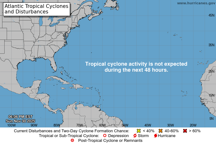
Atlantic Tropical Weather Outlook
From the National Hurricane Center:
For the North Atlantic Caribbean Sea and the Gulf of Mexico: A non-tropical low pressure system located about 650 miles southeast of Bermuda is producing a few disorganized showers and T-Storms to the north and east of the center. Environmental conditions are expected to be only marginally conducive for development during the next day or so as the low moves northeastward before it is absorbed by an approaching frontal system over the north-central Atlantic. * Formation chance through 48 hours low 30 percent. * Formation chance through 5 days low 30 percent. A non-tropical low pressure system over the far eastern Atlantic is expected to move southward about midway between Portugal and the Azores over the weekend. Environmental conditions are forecast to be marginally conducive for the low to acquire subtropical characteristics early next week while it meanders just to the north of the Canary Islands. Additional information on this system can be found in high seas forecasts issued by Meteo France. * Formation chance through 48 hours low 10 percent. * Formation chance through 5 days low 30 percent. High seas forecasts issued by Meteo France can be found under WMO header FQNT50 LFPW. Forecaster Reinhart/Latto
Today’s North Texas Hazardous Weather Forecast
Saturday’s Forecast
Overnight Update
This Evenings North Texas Hazardous Weather Forecast
Friday Night Forecast for the Dallas – Fort Worth Metroplex
Early Friday Afternoon Update
Friday’s North Texas Lake Levels
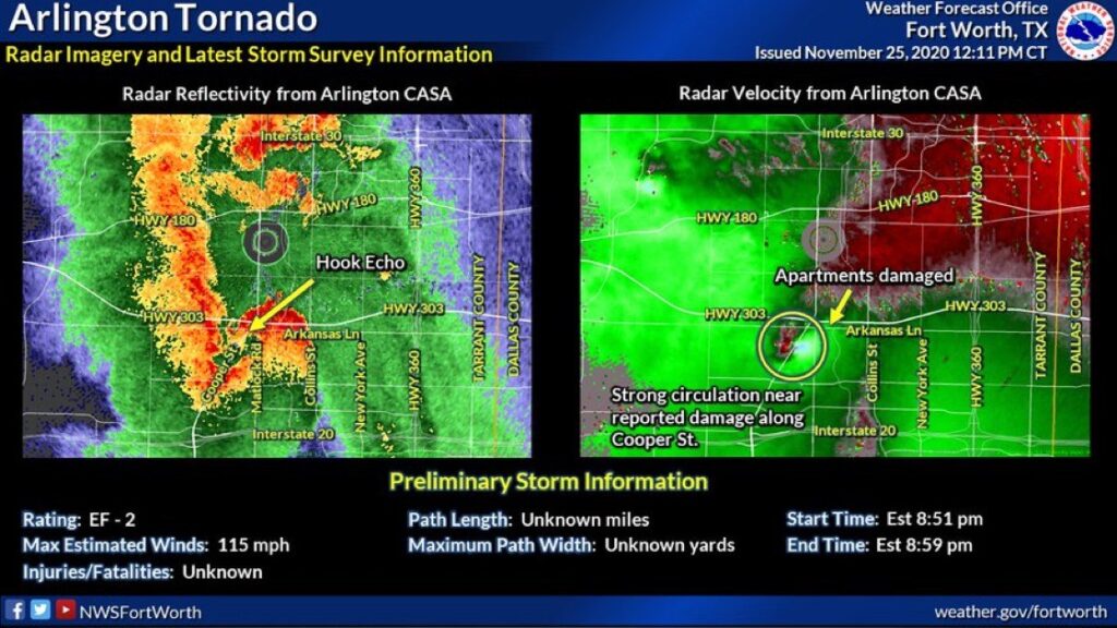
EF-2 Arlington Tornado – Initial NWS Fort Worth Report

from NWS Fort Worth:
Arlington Tornado 11/24/20…
A line of strong to severe thunderstorms moved across North and
Central Texas during the evening of November 24, 2020. Most of the
damage was attributed to straight-line winds, however, an NWS survey
crew determined that an EF2 tornado struck portions of Arlington
just before 9 PM.
Rating: EF2
Estimated Peak Wind: 115 mph
Path Length /statute/: 5.0448 miles
Path Width /maximum/: 150.0 yards
Fatalities: 0
Injuries: 5
Start Date: 11/24/2020
Start Time: 08:51 PM CST
Start Location: 1 E Dalworthington Gardens / Tarrant
County / TX
Start Lat/Lon: 32.692 / -97.1472
End Date: 11/24/2020
End Time: 08:58 PM CST
End Location: 3 WNW Grand Prairie / Tarrant County / TX
End Lat/Lon: 32.7204 / -97.0684
Survey Summary:
An EF-2 tornado moved through Arlington producing mostly EF-0 and
EF-1 damage, but a small area of EF-2 damage was found. The tornado
began near West Mayfield Road and South Bowen Road where fence, shed
and tree damage was found. The tornado traveled northeast from this
location causing minor tree damage. Significant roof damage to
several structures was noted along Colorado Lane. The tornado then
crossed South Cooper Street and damaged a Burger Box fast food
restaurant, Safelite AutoGlass store, and several warehouses in the
area. The tornado damage in this location and along Colorado Lane
was at EF-1 intensity. The tornado continued along an east-northeast
track where it soon impacted the Waterdance and Mirage Apartments.
Considerable roof damage was noted at these complexes, but the most
significant damage occurred at the Waterdance Apartment complex.
Large sections of the roof were ripped off of two buildings,
resulting in an EF-2 rating at this location. From the apartment
complex, the tornado weakened and traveled northeast for a few more
miles before dissipating near East Park Row Drive and Carter Drive.
Sporadic tree, siding, fence, and shingle damage was noted to the
end of the path. The maximum winds with this tornado were around
115 mph.
EF Scale: The Enhanced Fujita Scale classifies tornadoes into the
following categories:
EF0…Weak……65 to 85 mph
EF1…Weak……86 to 110 mph
EF2…Strong….111 to 135 mph
EF3…Strong….136 to 165 mph
EF4…Violent…166 to 200 mph
EF5…Violent…>200 mph
