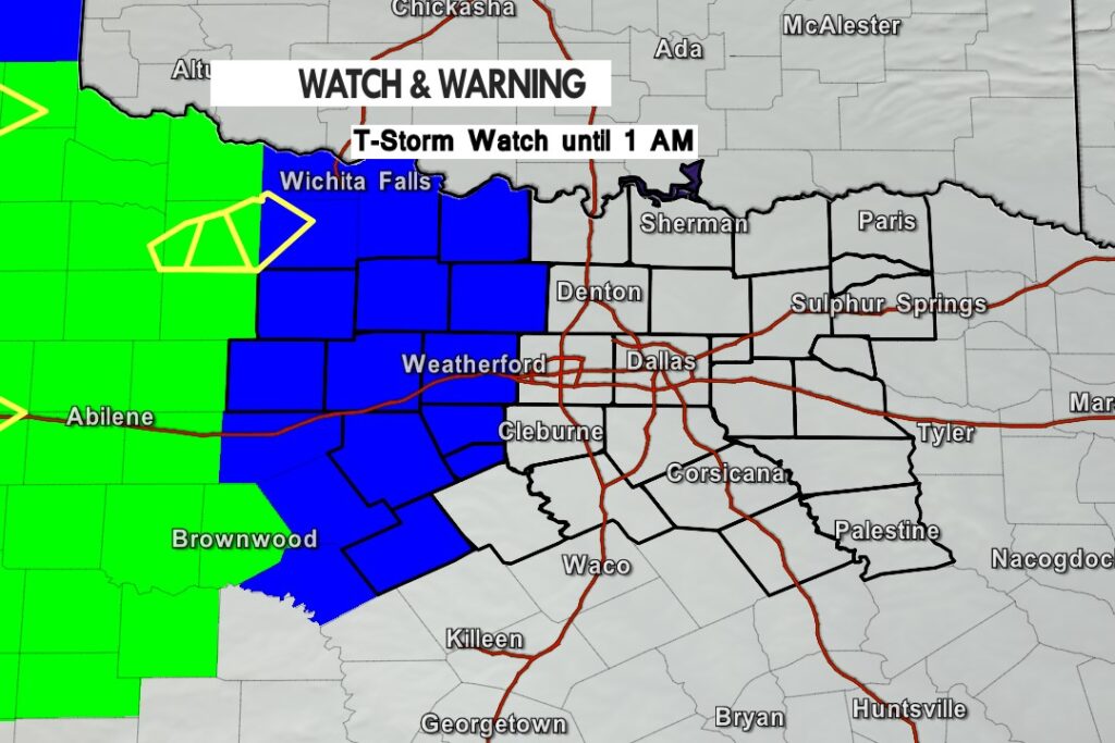
A T-Storm Watch has been issued for parts of North Texas until 1 am for the counties in blue. 65 mph wind gusts and up to golf ball sized hail is possible.
A T-Storm Watch has been issued for parts of North Texas until 1 am for the counties in blue. 65 mph wind gusts and up to golf ball sized hail is possible.

From William Cole: A T-Storm Watch has been issued in the Texas Weather Tracker TV coverage area for the following counties until 1:00 AM Tuesday. Erath, Hamilton, Hood, Jack, Montague, Palo Pinto, Parker, Somervell, Stephens, Wise & Young.
We’ll have Live Severe Weather Coverage on the channel – which includes Texas’ #1 Storm Chasing Team – as needed. Be sure to download our free Texas Weather Tracker TV mobile app and add our Live channel to your Roku, Apple or Amazon Fire TV device.
Stay with William Cole and Texas Weather Tracker TV for continuing coverage, online, on our app and on TV. Let’s stay safe together.

William’s North Texas Hazardous Weather Forecast this Evening:
One or more thunderstorm complexes are expected to affect most of the region late this evening and overnight as they arrive from the west. These storms could pose threats for damaging wind gusts as well as embedded tornadoes and hail. In addition, heavy rainfall may lead to flash flooding and additional rises on rivers and streams.
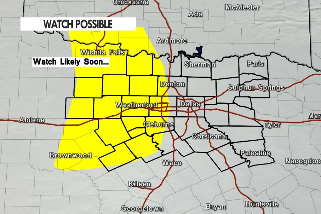
The Storm Prediction Center says a weather watch will be issued soon for our Western Counties.
Severe weather currently out in the South Texas Panhandle will eventually turn into a complex of storms and push east into North Texas late this evening and overnight. The severe risk will be decreasing but quarter to half dollar sized hail with winds to 65 mph are possible.
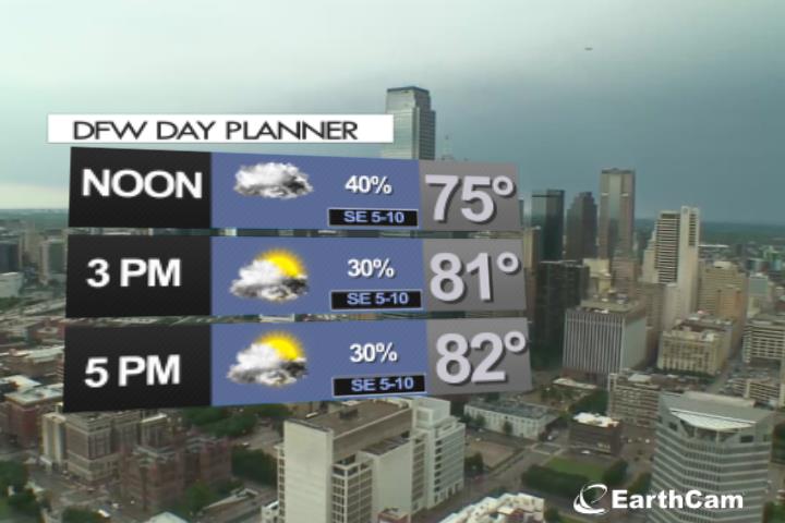
DFW TONIGHT…A chance of showers and thunderstorms this evening, then showers and thunderstorms after midnight. Lows in the upper 60s. Southeast winds 5 to 10 mph. Chance of rain near 100 percent. -William


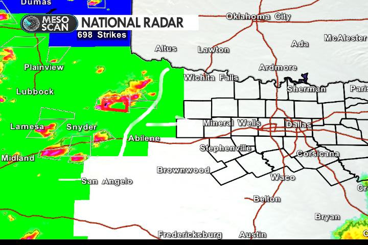
Here’s a look at Live Temperatures across North Texas, MesoScan Radar and the Updated Forecast Map.
DFW THIS AFTERNOON…Partly sunny. Highs in the lower 80s. Southeast winds 5 to 10 mph. -William


Here are Sunday’s Live Lake Levels across North Texas.

From the National Hurricane Center:
For the North Atlantic…Caribbean Sea and the Gulf of Mexico:
Tropical cyclone formation is not expected during the next 5 days.
$$ Forecaster Brown
The morning rain will tapper off and with some afternoon sun it will be a very muggy and humid afternoon. Scattered afternoon T-Storms are possible.