CLAUDETTE MOVING QUICKLY OVER THE NORTHWESTERN ATLANTIC AWAY FROM THE UNITED STATES

Texas Weather Tracker TV Alert

CLAUDETTE MOVING QUICKLY OVER THE NORTHWESTERN ATLANTIC AWAY FROM THE UNITED STATES

At 500 PM EDT (2100 UTC), the center of Tropical Storm Claudette was located near latitude 37.5 North, longitude 72.1 West. Claudette is moving toward the east-northeast near 29 mph (46 km/h). An east-northeastward to northeastward motion with some increase in forward speed is expected over the next day or so. On the forecast track, Claudette will move across the northwestern Atlantic Ocean tonight, and pass just south of Nova Scotia on Tuesday.

Download App

If you have not already downloaded the Free Texas Weather Tracker TV mobile app – do that now. Search your app store for Texas Weather Tracker TV. Also, add our free Live Channel to your TV through Roku, Apple or Amazon Fire TV streaming players.

Streaming Servicet

Like our forecasts? Love our severe weather coverage? Help support us and local Texas weather coverage. Join our Patreon for $2.99 per month. www.patreon.com/texasweathertrackertv

Patreon

Early Monday Afternoon Update

Texas Weather Tracker TV Alert

Here’s a look at Live Temperatures across North Texas, MesoScan Radar and the Updated Forecast Map.

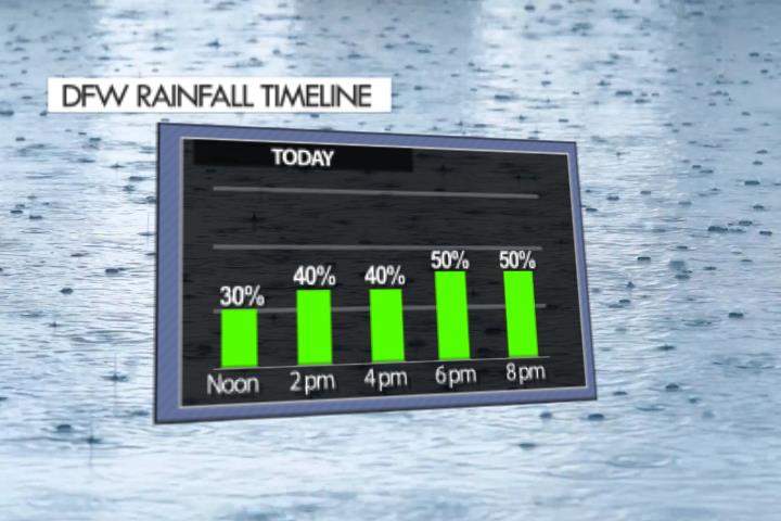
DFW TODAY…Partly sunny. A 50 percent chance of showers and thunderstorms this afternoon. Highs in the mid 90s. Temperatures falling into the mid 80s this afternoon. South winds 5 to 10 mph, becoming north 10 to 15 mph this afternoon. -William

Texas Weather Tracker TV Alert

Texas Weather Tracker TV Alert

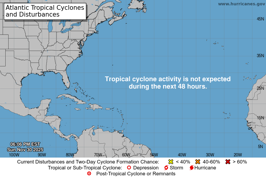
Atlantic Tropical Weather Outlook

Texas Weather Tracker TV Alert

From the National Hurricane Center:

For the North Atlantic…Caribbean Sea and the Gulf of Mexico:
The National Hurricane Center is issuing advisories on recently upgraded Tropical Storm Claudette, located inland over northeastern North Carolina.
A well-defined tropical wave located about 900 miles east-southeast of the Windward Islands is producing disorganized showers and thunderstorms. Some development of this disturbance will be possible during the next couple of days before upper-level winds become less conducive for further organization by Thursday. The system is expected to move westward to west-northwestward at around 15 mph. * Formation chance through 48 hours…low…20 percent. * Formation chance through 5 days…low…20 percent.
$$ Forecaster Stewart