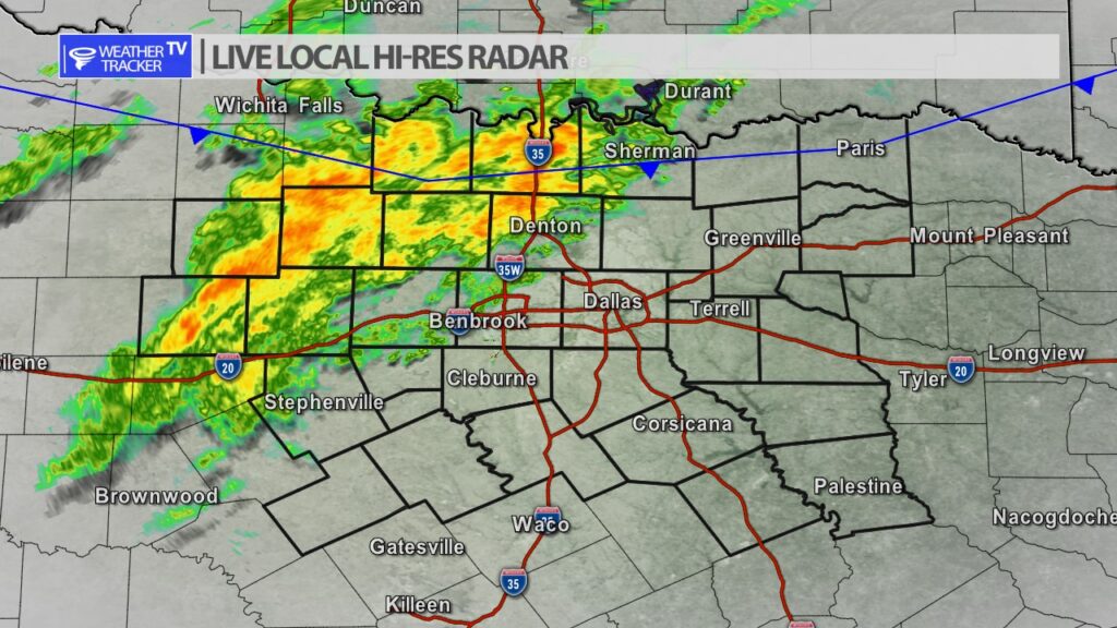
William’s Severe Weather Zone for Tuesday:
At the surface, 11Z analysis showed a cold front over south-central VA, becoming quasistationary across the Appalachians to middle TN, then a warm front west-southwestward across southeastern OK and northwest TX. A separate low was drawn over north-central KS, along a front extending over eastern CO and southeastern NE. The low will move eastward, while the warm front moves north and merges with the northern frontal zone. The combined boundary should move southward as a cold front over the south-central Plains and MO tonight, reaching the lower Ohio Valley, Ozarks, central/western OK and southeastern CO by 12Z. The western segment of this boundary should move northward again as a warm front late in the period over eastern CO, as the aforementioned shortwave trough approaches. …Lower Mississippi Delta region and vicinity… Widely scattered thunderstorms are possible mainly this afternoon into early tonight, in a plume of low-level convergence and moisture transport. Damaging gusts and hail near severe limits are possible, and a marginal tornado threat is apparent as well. Moisture-channel imagery also indicates a low-latitude perturbation and associated midlevel UVV field moving north-northwestward from the Yucatan Peninsula to the south-central Gulf. This feature — which is expected to approach the mouth of the Mississippi River around 00Z – will contribute subtle but still supportive DCVA/ascent to the environment. This, along with rich low-level moisture/ theta-e and diurnal boundary-layer destabilization inland, will yield MLCAPE around 1000 J/kg potentially as far north as around I-20, amidst 35-45-kt effective-shear magnitudes. This will support organized multicells and at least transient supercell potential, given effective SRH around 100-200 J/kg. The outlook line was extended inland somewhat in deference to the presence of SBCAPE farther north, and some erosion of the EML-base stable layer in time series of forecast soundings. However, the northward extent of severe potential still will be limited by the associated capping and weak midlevel lapse rates. …North TX/southern OK, around 12Z tomorrow… Isolated to scattered thunderstorms should develop within a couple hours either side of 12Z tomorrow — the end of the day-1 forecast period. Activity will be related to low-level moistening within a zone of elevated warm advection, beneath suitably steep midlevel lapse rates to support MUCAPE of 500-1500 J/kg. Forecast soundings show that, for the more-aggressive destabilization scenarios with thickest CAPE layers, 45-50-kt effective-shear magnitudes are possible within the first couple hours after initiation. This indicates some hail potential may accompany the most-intense cells, especially around the southern and eastern rim of the convective plume, where activity will have access to greatest low-level theta-e and deepest buoyancy. A hail area may need to be added in a future outlook if confidence increases in activity initiating early enough to mature to marginally severe levels prior to 12Z. ..Edwards/Gleason.. 12/28/2021 $$

